MATRIX MAPPING TOOLS – LAYERS
Did you know that the Map Search feature in Matrix can do more than display listings? You can use the map to display key data, including regions, municipalities/sub-areas, neighbourhoods and points of interest. Here’s how:
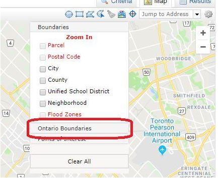
1.From the Search screen, click on Map Search. Then, click on the Layers button, located at the top right corner of the map

2. To display the outlines for regions, municipalities/sub-areas and neighbourhoods on the map, select Ontario Boundaries from the layers drop down list:

Whatever overlay you choose will appear on the map.

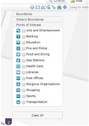
3. To display several different points of interest, Select Points of Interest from the Layers menu. This will allow you to display the following on your map:
- Arts and Entertainment
- Banking
- Education
- Fire and Police
- Food and Dining
- Gas Stations
- Health Care
- Libraries
- Post Offices
- Religious Organisations
- Shopping
- Sports
- Transportation
Points of interest will appear as blue icons on the map. Please be aware, however, that points of interest are not available if you have the map zoomed out. If you zoom in enough so points of interest are available, the text for the selections will be black, as shown below. If they are in red, you will need to zoom in further.

Please feel free to contact the RAHB MLS® Department with any questions, at 905.667.4650 or support@rahb.ca
